SERVICES
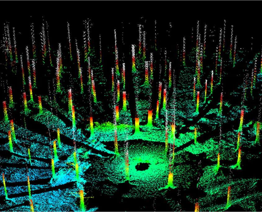
LiDAR PROCESSING AND ANALYSIS
We offer LiDAR data capture, processing and analysis services to the natural resource and engineering industries. Through the use of drones, we have been able to significantly reduce the cost of traditional LiDAR data collection.
Our LiDAR services include Digital Surface Model (DSM, DEM/DTM) generation, where we can create slope, aspect, and elevation classes, contours, hillshades, and intensity images. We can also produce models and maps for hydrology purposes from these Digital Surface Models.
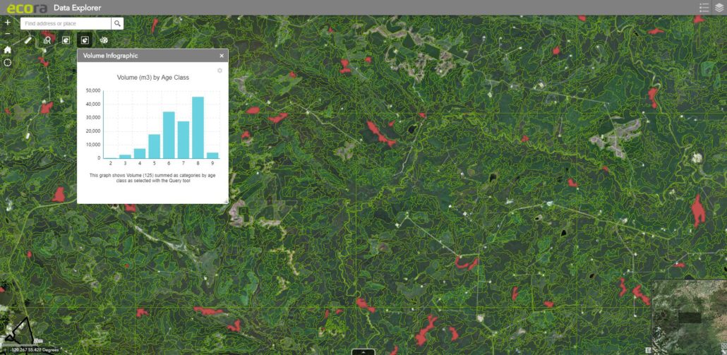
Our forestry team offers many forestry-specific LiDAR measurements, estimates, and analyses. Direct measurements include tree height, stand density, and crown closure. Estimates include volume, Diameter at Breast Height (DBH), Basal Area, and biomass. Using LiDAR, Ecora can also obtain forest parameters as direct measurements or estimates (derived through modeling) for Vegetation Resources Inventory (VRI) work.
SERVICES
DATA MANAGEMENT
Ecora offers a range of data management solutions from storage and maintenance to full scale corporate data stewardship. Data management services include:
Data Management Services
- Database design, implementation and maintenance
- Ongoing stewardship of corporate data sets
- Spatial data compilation and management
- Digital data loading, conversion and integration
DATA MANAGEMENT WEB APPLICATION
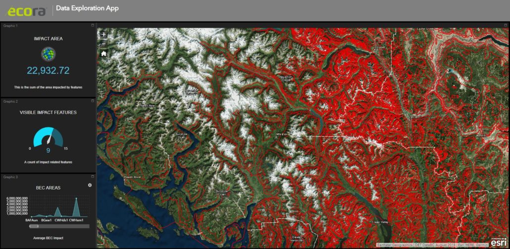
Ecora has built a data management system with an internet mapping tool that meets all needs of Community Forests and other small licensees. Ecora’s web mapping forms the basis of a “best practices” management plan by allowing small licensees permanent access to their spatial data and enhancing business decisions using up to date spatial information. In addition, community values such as hiking and ski trails, and other outdoor activities can be mapped and published in a format the public can access. The goal is to provide an affordable product that enables the small licensee to do the work themselves, but also provides easy access to expertise at Ecora.