SERVICES
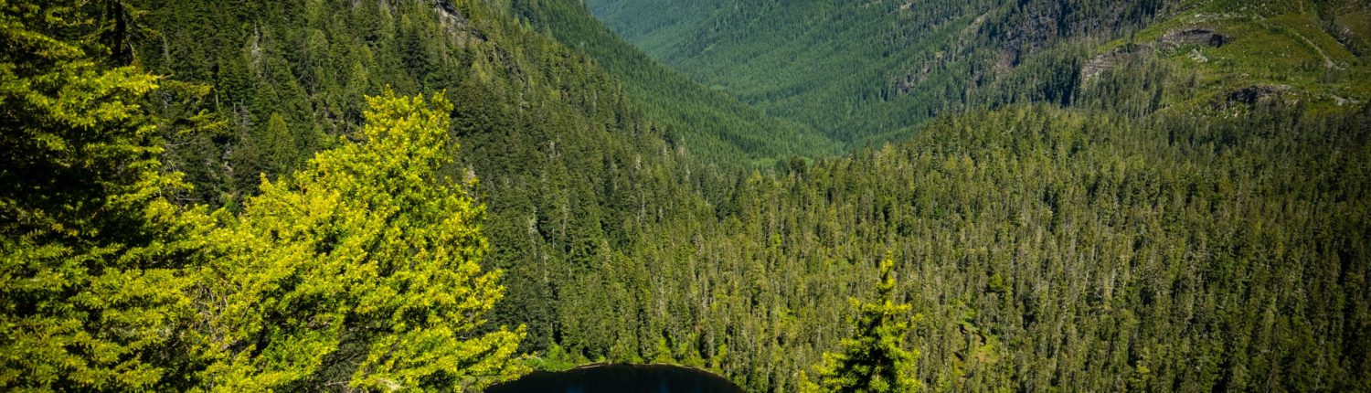
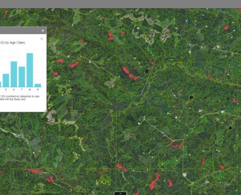
RESOURCE INVENTORY
Ecora’s resource inventory team of certified inventory specialists provides expertise in the delivery of traditional inventory products – vegetation resources inventory, landscape vegetation inventory and national forest inventory – and the design and delivery of customized inventory products that include LiDAR data integration, silviculture updates, and permanent sample plot establishment and re-measurement. From landscape-level inventories to small private parcels, our team maximizes client value through innovation, technology, and efficiency.
- British Columbia Vegetation Resources Inventory (VRI)
- SIBEC
- Ecosystem Mapping (Predictive Ecosystem Mapping, Terrestrial Ecosystem Mapping)
- Cultural and Medicinal Plant Inventories
- Predictive and Enhanced Forest Inventories (PFIs and EFIs) using Remote Sensing and field data.
SERVICES
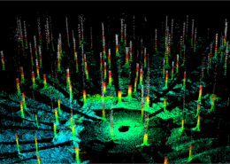
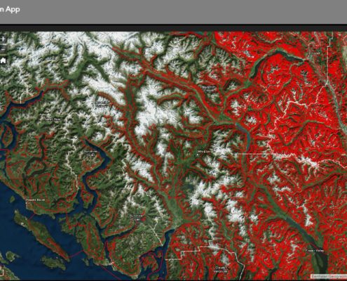
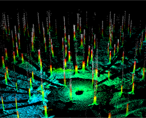
REMOTE SENSING AND LIDAR ANALYSIS
Our remote sensing team offers an array of products to maximize the returns on your LiDAR investment. Combined with the experience of our Resource Analysis team we are able to implement the solutions you need on any landbase whether it is forestry, environment, water or urban.
- Facilitate Imagery and LiDAR Acquistion to meet the needs of your project
- Terrain Products including slope, aspect, elevation, contours, hillshades, and intensity
- Digital Surface Models, Digital Elevation Models and Digital Terrain Models
- Hydrology Products including watershed delineation, stream networks and classifications
SERVICES
CARBON MODELING
For companies interested in pursuing forest carbon offsets, Ecora’s team can assist in aspects of the project. From initial design, through monitoring, certification and verification, our team can provide the support required to undertake a carbon offset project.

CONTACT INFORMATION:
Dwight Crouse
Team Lead, Resource Analysis & Remote Sensing
Phone: 250.469.9757 x1088
Dwight.crouse@ecora.ca